Image

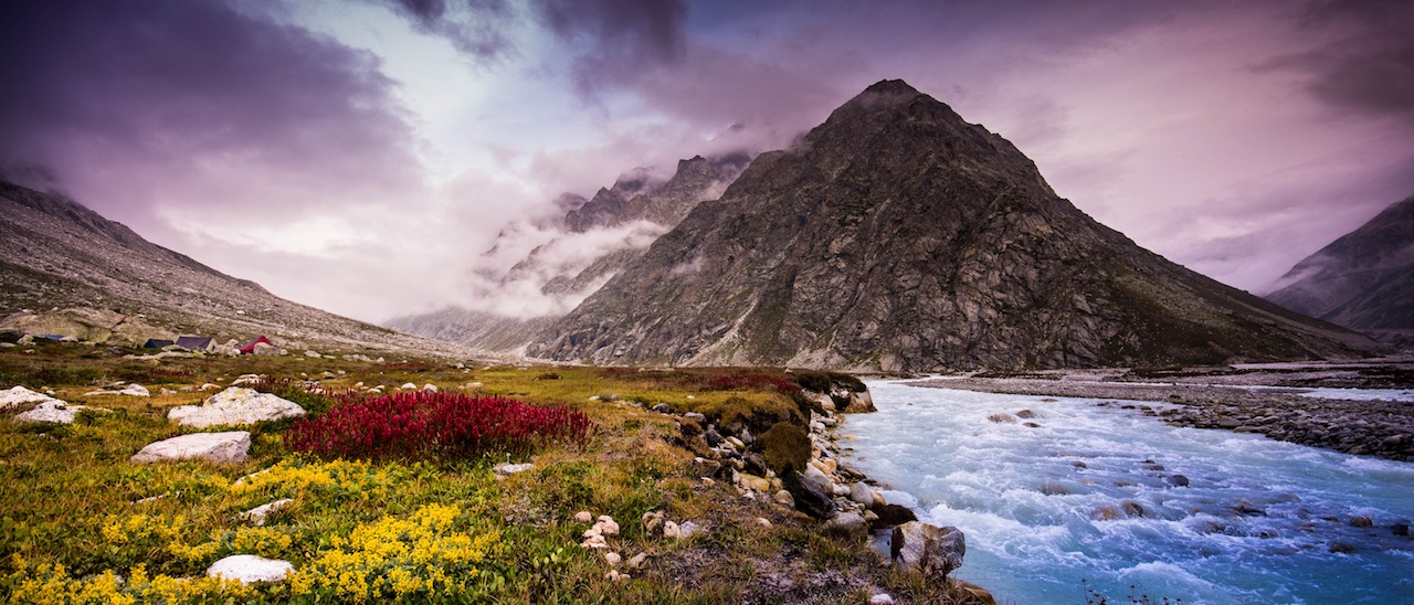
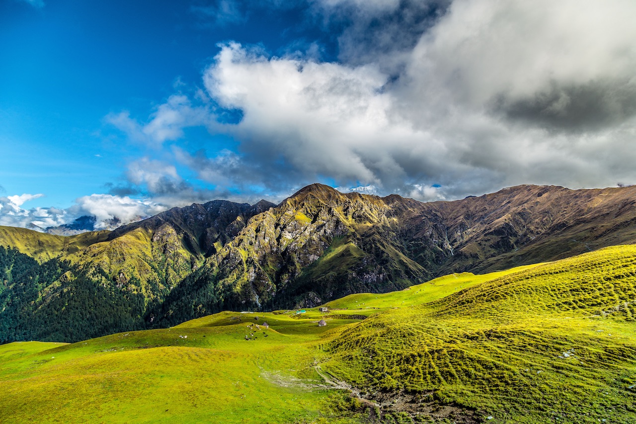
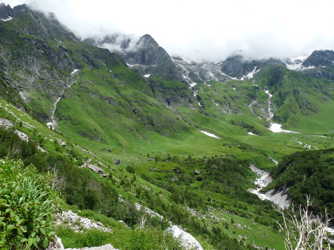
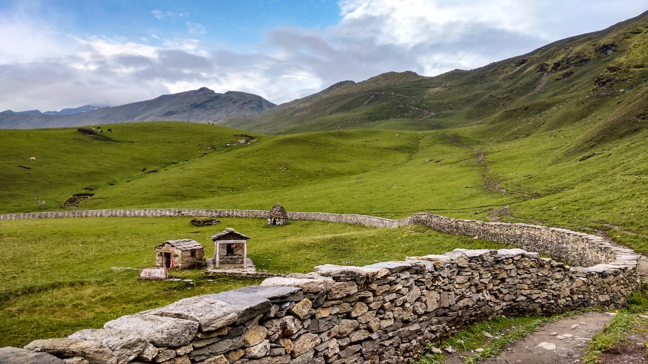
Bedni Kund, Nanda Devi National Park, Uttarakhand, India, A World Heritage Site recognized by UNESCO

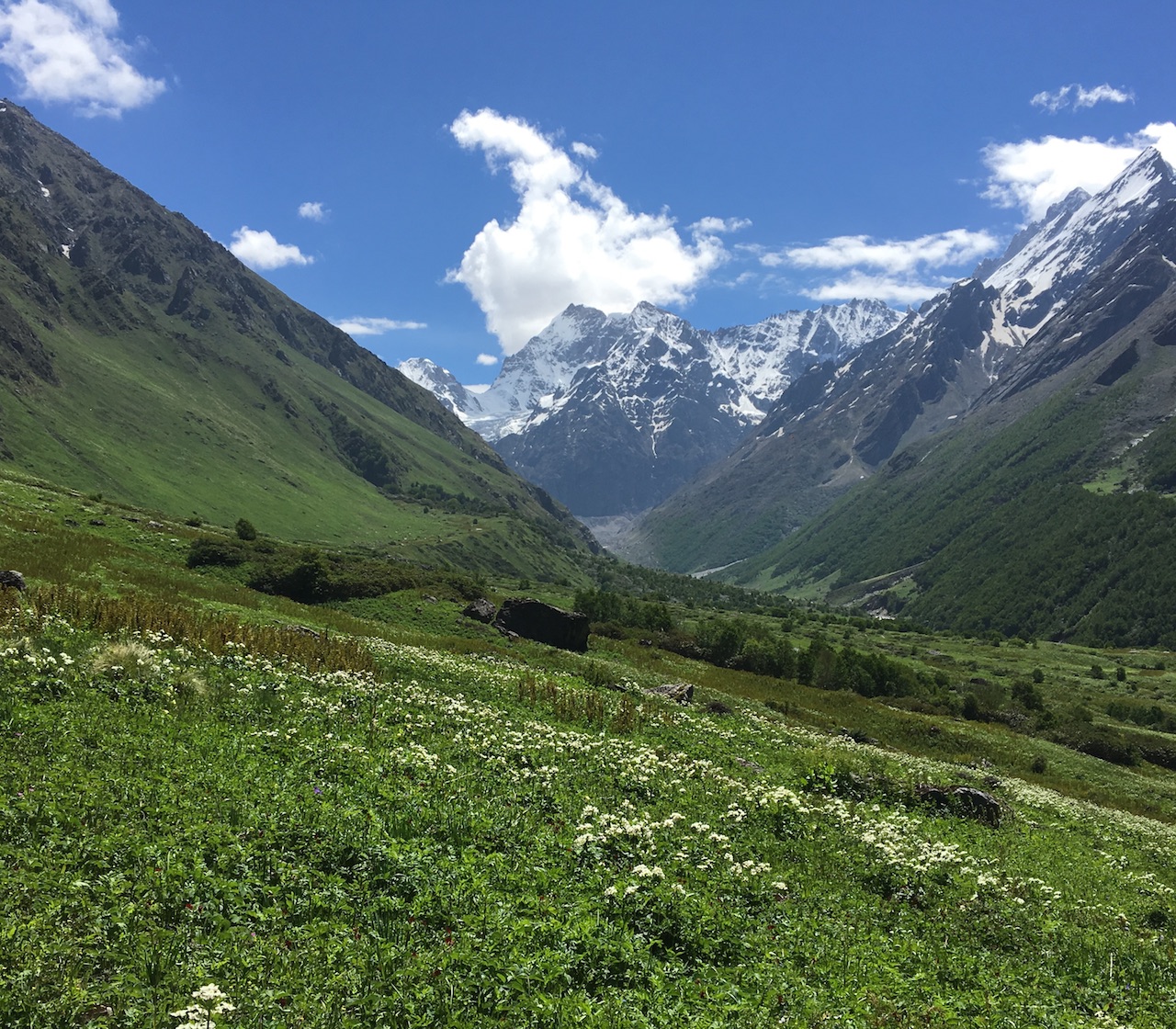
With encircling Himalayan conifers you would find Bedini Kund a glacial lake amidst the lush green alpine meadows of Bedini Bugyal in Chamoli, Uttarakhand. A part of Nanda Devi National Park that is recognized as a World Heritage Site by UNESCO.

Bedini Kund was known as Vaitarani in ancient times and whilst trekking you may stumble upon lotus near Bedini Kund - also known as Brahm Kamal the one as per Puranas you find in the hands of Brahma or the Creator of the Universe. Did you know that Bhrahm Kamal or Saussurea obvallata is a species native to the Himalayas and the state flower of Uttarakhand?

Bedini Kund is a spring-generated waterbody (not currently) and local legend says that Vyasa composed the four Vedas at this place and you would find a pair of his wooden slippers in the nearby temple along with shrines of Durga and Gauri.

How to reach Bedni Kund via Bedini Bugyal, Chamoli, Uttarakhand, India?

Tag : Travel Uttarakhand | Content: gud2travel.com | Image: Ankitv2512 | Update: 14-Mar-2021
Image

River Alaknanda, Panch Prayag, Uttarakhand, India

Alaknanda a Himalayan river that originates from two glaciers - Satopanth glacier and Bhagirathi glacier situated near Vashundhara falls in Uttarakhand.

Alaknanda joins river Saraswati at Mana and then flowing further down joins Dholiganga at Joshimath. From there it deviates to meet river Bhagirathi at Devprayag.

Many rivers merge with the Alaknanda forming the holy confluence of rivers of Panch prayag - Alanknanda merges Dhauliganga at Vishnuprayag; it merges with Nandakini at Nandaprayag; it merges with Pindar at Karnaprayag; next it merges with Mandarin at Rudraprayag; and on merging with Bhagirathi at Devprayag it emerges as the sacred river Ganga.

The sacred town of Badrinath lies on the banks of the Alaknanda river.

Tag : Travel Uttarakhand | Content: gud2travel.com | Image: Sharada Prasad | Update: 14-Mar-2021
Image

Nanda Devi Mountains, Nanda Devi National Park, Uttarakhand, India, A World Heritage Site recognized by UNESCO

Nanda Devi, the second highest in India, with an aura of inaccessibility almost like a ethereal sign hangs audaciously encompassing it 'forbidden territory'

The Nanda Devi National Park is encircled by a spectacular range of mountains, such as Trishul (7,120m), Dunagiri (7,066m) and Changabang (6,864m). Lata and Tolma villages are the two entry points to the Nanda Devi National Park (note - the climb from Tolma is easier than from Lata)

Nanda Devi National Park is recognized as a World Heritage Site by UNESCO. How to reach Nanda Devi National Park, Uttarakhand, India?

Tag : Travel Uttarakhand | Content: gud2travel.com | Image: Asheeshmamgain | Update: 14-Mar-2021
Image

Valley of Flowers, Chamoli, Uttarakhand, India, A World Heritage Site recognized by UNESCO

A quest for the famous bursts of color is what may have gotten you to research  a trek to Valley of flowers - but soon you would experience that it is the journey and not the destination that makes it worth your while.

It's a 13+ km trek (varied distance/s depending on where you start) where the first 80% of the trek from Govind Ghat to Ghangaria is labelled as easy as well as moderately difficult. Second part of the trek is supposedly a strenuous one.

When you trek the first hour may be the toughest than you fall in your own hypnotic rhythm and quietude follows and once in a while your thoughts meander with wispy clouds and are just focussed for that one cup of steaming hot chai :)

Since the valley is in full bloom between mid July to mid August be prepared for rain - especially at dawn - valley calls and big fat drops may just start pouring and if you are lucky enough the drumbeats may pause or may taunt you with a patter again.

Valley of Flowers National Park is recognized as a World Heritage Site by UNESCO. How to reach Valley of Flowers, Uttarakhand, India?

Tag : Travel Uttarakhand | Content: gud2travel.com | Image: Naresh Chandra | Update: 14-Mar-2021
Image

Panchachuli Peaks, Trek, Munsiyari, Uttarakhand, India

It seems the pull of Panchachuli peaks is not only a thrilling hike - as and when your lens finally does gets to clench its vast panorama the vista delivers a powerful punch. The hike is inundated with endless meadows perfect to pitch a tent and too many waterfalls on the glacier as well as a coniferous forest of high oaks, birch and deodar trees. How to reach Panchachuli Base Camp?  How to reach Munsiyari?

Tag : Travel Uttarakhand | Content: gud2travel.com | Image: Arjunhaarith16 | Update: 14-Mar-2021
Image

Munsiyari, Kumaon region, Uttarakhand, India

Munsyari in Uttarakhand India is a verdant secret of Kumaon hills. Munsyari is almost engulfed by snowcapped mountains and dense forests and is favored by nature lovers and adventurers. You could opt for glacier treks to Milam and Ralam starting from Munsyari or enjoy stupendous views of the Panchachuli peaks doing a 2 day trek to Khuliya Top. Its really not necessary to exert yourself as Munsyari paints a vivid canvas of golden dawns and chrome sunsets. How to reach Munsiyari?

Tag : Travel Uttarakhand | Content: gud2travel.com | Image: Arjunhaarith16 | Update: 14-Mar-2021
Image

Mukteshwar, Uttarakhand, India

I am told that I should head to Mukteshwar if I am seeking tranquility as well as enjoy the chirping symphonies of the birds.

And whilst I am there I could also offer my prayers at the 350 year old Mukteshwar temple dedicated to Shiva as it does delivers dazzling views of Himalayas.

Mukteshwar is a scenic village perched high up in the Kumaon hills at a distance of about 51 kms from Nainital, Uttarakhand, India. How to reach Mukteshwar?

Tag : Travel Uttarakhand | Content: gud2travel.com | Image: Ashwini Chaudhary | Update: 14-Mar-2021
Image

Naini Lake, Nainital, Uttarakhand, India

Enchanting crescent shaped Naini or Nainital Lake is a natural freshwater body, located in Nainital, Uttarakhand, India.  How to reach Naini Lake?

Tag : Travel Uttarakhand | Content: gud2travel.com | Image: Abhishek gaur70 | Update: 14-Mar-2021
Image

How to reach Bedni Kund via Bedini Bugyal, Chamoli, Uttarakhand, India?

Bedini Bugyal is a classic rolling alpine meadow, probably the largest in the Himalayas where you would alway have the Mounts of Nanda Ghunti and the majestic Trishul for company at times almost startlingly clear at times invisible but you can still feel them.

What should you expect - From many descriptions we guess - Pine-draped mountains rising into the clouds all around and vast florescent green meadows with little cabin-like-homes.

How to reach Bedini Bugyal by air and which is the nearest airport to Bedini Gugyal?
The nearest airport is Jolly Grant is Dehradun Airport at a distance of about 312 km from Bedini Bugyal.

Delhi International Airport at a distance of about 520 km from Bedini Bugyal.

How to reach Bedini Bugyal by train and which is the nearest railway station to Bedini Gugyal?
The nearest railway station is at Haridwar at a distance of about 288 km from Bedini Bugyal.

Distance between various places to reach Bedini Bugyal to visit Bedini Kund
Delhi > [220 kms| > Haridwar > [20 kms| > Rishikesh > [268 kms| > Wan > [Trek 4.5 kms| > Bedini Bugyal > [4.5 kms| > Wan > [307 kms| > Dehradun

Ensure your small backpacks are were filled with dry fruits, water, a med-kit, raincoats, torches and off course walking sticks.

Tag : Travel Uttarakhand | Content: gud2travel.com | Image: Shaswat Nimesh | Update: 14-Mar-2021
Image

How to reach Valley of Flowers, Uttarakhand, India?

Best time to visit the Valley of Flowers is in the months of July and August (various flower species blooms at different times). The valley is open from beginning of June until the beginning of October and is closed as well as covered in snow the rest of the year.

How to reach Valley of Flowers in Uttarakhand. by air and which is the nearest airport to Valley of Flowers in Uttarakhand ?
The nearest airport is Jolly Grant is Dehradun Airport at a distance of about 287 km from Valley of Flowers in Uttarakhand.

Delhi International Airport at a distance of about 515 km from Valley of Flowers in Uttarakhand.

How to reach Valley of Flowers in Uttarakhand. by train and which is the nearest railway station to Valley of Flowers in Uttarakhand ?
The nearest railway station is at Rishikesh at a distance of about 272 km from Valley of Flowers in Uttarakhand.

You could also opt to travel from train to Haridwar that is at a distance of about 291 km from Valley of Flowers in Uttarakhand.

Distance between various places to reach Valley of Flowers
If you start the journey from - Delhi
> [220 kms| > Haridwar > [20 kms| > Rishikesh > [75 kms| > Rudraprayag > [ 115 kms| > Joshimath> [21 km] > Govind Ghat > [9.7 km] > Ghangaria > [trek 3.2+ km] > Valley of Flowers 

You could break up the journey from - Rishikesh > {75 km] > Devprayag > {68 km] > Rudraprayag > {119 km] > Nandprayag > {62 km] > Joshimath> [21 km] > Govind Ghat > [9.7 km] > Ghangaria > [trek 3.2+ km] > Valley of Flowers

You could start the journey from - Dehradun > [47 km] > Rishikesh > {255 km] > Joshimath > [21 km] > Govind Ghat > [9.7 km] > Ghangaria > [trek 3.2+ km] > Valley of Flowers

Nanda Devi National Park > [12.5 km] > Valley of Flowers

Do check with to reconfirm this information from local travel sources.

Tag : Travel Uttarakhand | Content: gud2travel.com | Image: Kp Vasant | Update: 14-Mar-2021
Image

How to reach Nanda Devi National Park, Uttarakhand, India?

How to reach Nanda Devi National Park by air and which is the nearest airport to Nanda Devi National Park?
The nearest airport is Jolly Grant is Dehradun Airport at a distance of about 286 km from Nanda Devi National Park.

Delhi International Airport is at a distance of about 514 km from Nanda Devi National Park.

How to reach Nanda Devi National Park by train and which is the nearest railway station to Nanda Devi National Park
The nearest railway station is at Rishikesh at a distance of about 272 km from Nanda Devi National Park.

You could also opt to travel from train to Haridwar that is at a distance of about 291 km from Nanda Devi National Park.

Distance between various places to reach Nanda Devi National Park
Delhi > [220 kms| > Haridwar > [20 kms| > Rishikesh > [75 kms| > Rudraprayag > [ 115 kms| > Joshimath > [29 kms| > Lata Village > [29 kms| > Joshimath > [267 kms| > Dehradun

Good read - on Nanda Devi National Park and directions to reach it by moxtain.com...

Tag : Travel Uttarakhand | Content: gud2travel.com | Image: Asheeshmamgain | Update: 14-Mar-2021
Image

How to reach Panchachuli Base Camp?

Trek to Panchachuli starts from Dar which is at a distance of 42 km from Dharchula the nearest town to the trekking base.

Distance between Munsiyari and Dharchula is about 94 km and takes about 3+ hours to reach by road.

Nearest airport to Dharchula is Pantnagar airport which is at a distance of 334 km.

The route from Delhi to Panchachuli Base Camp is
Delhi >> Kathgodam >> Almora >> Dharchula >> Tawaghat >> Sobla >> Dar >> Urthing >> Nagling >> Son >> Panchachuli Base Camp

(This note definitely needs more details... please do further research)

Tag : Travel Uttarakhand | Content: gud2travel.com | Image: Irumporai | Update: 14-Mar-2021
Image

How to reach Mukteshwar, Uttarakhand, India?

How to reach Mukteshwar by air?
The nearest airport to Mukteshwar is Pantnagar airport which is at a distance of about 95 km. Delhi International Airport is at a distance of about 337 km from Mukteshwar.

How to reach Mukteshwar by train?
The nearest Railway Station to Mukteshwar is Kathgodam Railway Station at a distance of about 72 km.

Tag : Travel Uttarakhand | Content: gud2travel.com | Image: Sumod K Mohan | Update: 14-Mar-2021
Image

How to reach Munsiyari, Pithoragarh, Uttarakhand, India?

How to Reach Munsiyari by air?
Dehradun airport is at a distance of about 214 kms from Munsiyari and Pantnagar airport is at a distance of 250 kms. Pantnagar is connected by daily flights from Delhi. Naini Saini Airport in Pithoragarh is at a distance of about 130 km from Munsiyari - note there are few flights to this airport.

Best time to visit Munsyari would be from March to June and September to October;

Tag : Travel Uttarakhand | Content: gud2travel.com | Image: Irumporai | Update: 14-Mar-2021
Image

How to reach Nainital, Uttarakhand, India?

How to reach Nainital by air?
The nearest airport to Nainital is Pantnagar airport which is at a distance of 70 km.

How to reach Nainital by train?
The nearest railway stations to Nainital is Kathgodam railway station and is at a distance of about 36 km.

Tag : Travel Uttarakhand | Content: gud2travel.com | Image: Akhil jayachandran | Update: 14-Mar-2021
Image

How to reach Naini Lake near Nainital, Uttarakhand, India?

Naini Lake is at a distance of about less than 2 km from Nainital.

How to reach Nainital by air?
The nearest airport to Nainital is Pantnagar airport which is at a distance of 70 km.

How to reach Nainital by train?
The nearest railway stations to Nainital is Kathgodam railway station and is at a distance of about 36 km.

Tag : Travel Uttarakhand | Content: gud2travel.com | Image: Abhishek gaur70 | Update: 14-Mar-2021
Image

Panchachuli peaks near Munsiyari, Pithoragarh, Uttarakhand, India

Panchachuli peaks near Munsiyari, Pithoragarh, Uttarakhand, India are a group of 5 snow-capped Himalayan peak popular amongst trekkers looking for a picturesque short trek. How to Reach Munsiyari?

Tag : Travel Uttarakhand | Content: gud2travel.com | Image: Irumporai | Update: 14-Mar-2021