Image

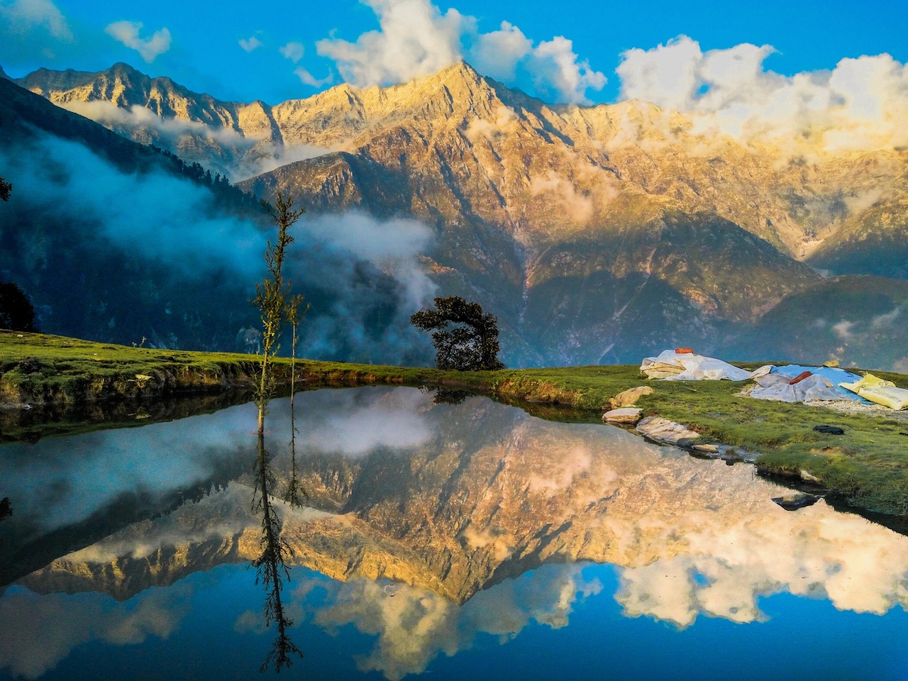
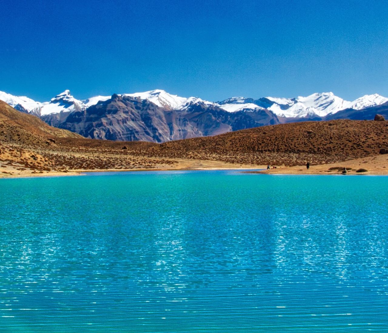
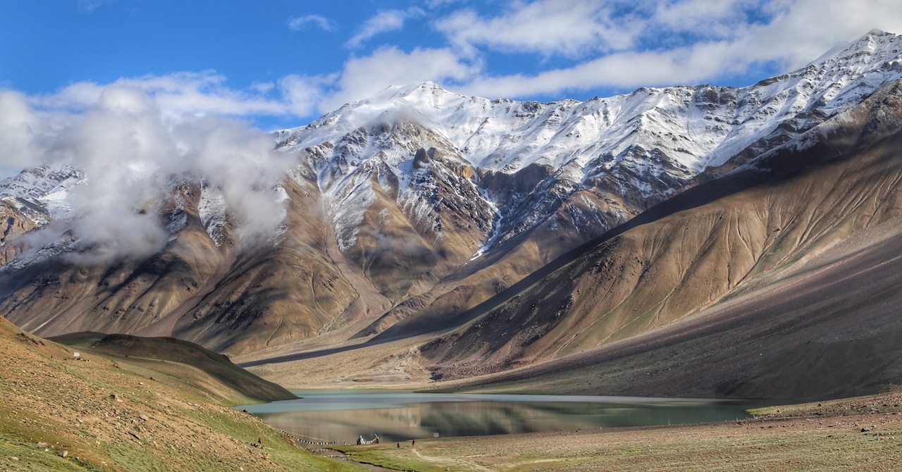
Chandra Taal, Spiti, Himachal Pradesh, India

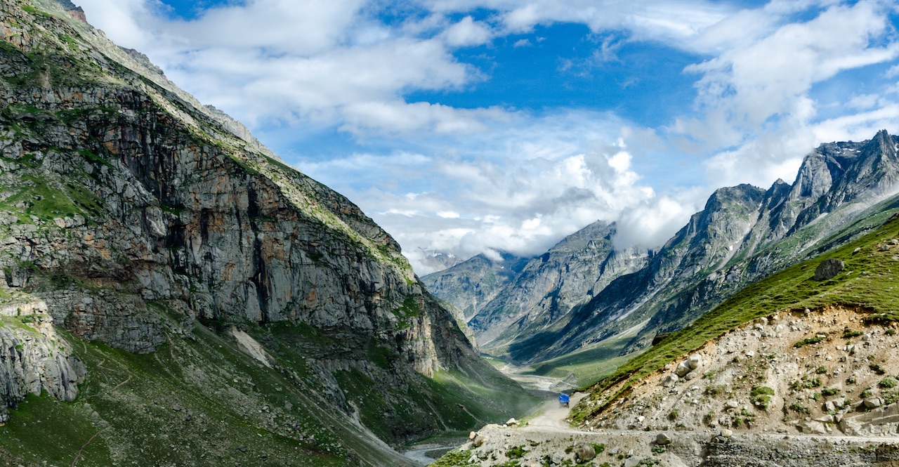
Chandra Taal or Chandra Tal is a crescent shaped lake situated in Spiti, Himachal Pradesh. Chandra Taal a favorite amongst trekkers and is situated at an altitude of about 4,300 metres (14,100 ft) in the Himalayas. The lake is accessible on foot from Batal as well as from Kunzum Pass from late May to early October. There is also a motor road accessible as far as a parking lot - that is about 2 km from the lake. How to reach Spiti Valley?

Tag : Travel Himachal Pradesh | Content: gud2travel.com | Image: Gurpreet1986 | Update: 14-Mar-2021
Image

How to reach Spiti Valley in Himachal Pradesh, India?

How to reach Spiti Valley by air?
There is no direct flight available to to Spiti Valley.  The nearest airport to Spiti valley is Bhuntar Airport near Kullu and Spiti Valley is at a distance of about 245 km from the same.

Note Bhuntar Airport has direct flights from Chandigarh and Delhi. Chandigarh International Airport is at distance of about 522 km from Spiti Valley.

How to reach Spiti Valley by train?
The nearest railway station to Spiti valley is Joginder Nagar Railway station which is ta a distance of about 340 km.

How to reach Spiti Valley by road?
Two road routes are preferred to reach Spiti, one is via Manali and the other is via Shimla and most travelers claim that the difference is only 20-25 kms so it is up to you to set your itinerary.

Bhuntar Airport > 50km > Manali > 52 km > Rohtang Pass > 14km > Gramphu > 18km > Chattru > 44 km > Kunzum Pass > 76 km > Kaza (Spiti Valley)

Chandigarh Airport > 127 km > Shimla > 256 km > Kinnaur > 62 km > Nako > 36 km > Sumdo > 29 km > Tabo > 49 km > Kaza.

Tag : Travel Himachal Pradesh | Content: gud2travel.com | Image: Ksuryawanshi | Update: 14-Mar-2021
Image

Rock Cut Temples of Masroor, Near Dharamshala, Himachal Pradesh, India

The Rock Cut Temples of Masroor are a unique example of monolithic temples over looking the Dhauladhar range of the Himalayas. The Masroor Rock Cut temples still a riddle for historians are dated to be built approximately between 6th to 8th century and are the only rock cut temples in North India. Rock Cut Temples of Masroor are located just about 43 kms from Dharamshala. How to reach Dharamshala?

Tag : Travel Himachal Pradesh | Content: gud2travel.com | Image: Akashdeep83 | Update: 14-Mar-2021
Image

Triund, Dharamshala, Himachal Pradesh, India

Alluring Triund, is a small hill station at the foot of the majestic Dhauladhar ranges - near Mcleodganj or Dharamshala in Himachal Pradesh, India. How to reach Dharamshala?

Views be it dusk or dawns are an absolute treat for the trekkers who have decided to pitch a tent here for the night as Triund offers both the scintillating Dhauladhar Mountains and the luscious green Kangra Valley...

Tag : Travel Himachal Pradesh | Content: gud2travel.com | Image: Mohit Khatri | Update: 14-Mar-2021
Image

How to reach Dharamshala in Himachal Pradesh, India?

How to reach Dharamshala by air?
Dharamshala is at a distance of about 15 km from Gaggal Airport which is well connected with Delhi and Chandigarh amongst other cities.

Distances of Dharamshala from nearby cities
Pathankot is at a distance of about 86 km from Dharamshala. Amritsar is at a distance of 203 km from Dharamshala. Chandigarh is at a distance of 242 km from Dharamshala. Delhi at a distance of 475 km from Dharamshala.

How to reach Dharamshala by train?
Pathankot Railway Station is the nearest railway station to Dharamshala and is at a distance of about 86 km.

Tag : Travel Himachal Pradesh | Content: gud2travel.com | Image: Japleenpasricha | Update: 14-Mar-2021
Image

Dharamshala, Prayer Tablets, Himachal Pradesh, India

These stone tablets with prayers inscribed found in Dharamshala, Himachal Pradesh, India - are Mani stones or stone plates, rocks and pebbles, inscribed as per Wikipedia with the six syllabled mantra of Avalokiteshvara - Om mani padme hum - as a form of prayer in Tibetan Buddhism.

Mani stones are intentionally placed along the roadsides and rivers or placed together to form mounds as an offering to spirits of place. How to reach Dharamshala?

Tag : Travel Himachal Pradesh | Content: gud2travel.com | Image: Wolfgang Maehr | Update: 14-Mar-2021
Image

Great Himalayan National Park, Himachal Pradesh, India is a UNESCO World Heritage Site

The Great Himalayan National Park amongst many fauna is home to Blue Sheep, Snow Leopard, Himalayan brown bear, Himalayan Tahr, Musk Deer - and your best chance of spotting any of them is between September and November as animals start their seasonal migration to lower altitudes.

It is part of the Himalaya biodiversity hotspot and includes twenty-five forest types including alpine, glacial, temperate, and subtropical forests.

Great Himalayan National Park in Himachal Pradesh, India is a UNESCO World Heritage Site. How to reach Great Himalayan National Park?

Tag : Travel Himachal Pradesh | Content: gud2travel.com | Image: Kinkhab | Update: 14-Mar-2021
Image

How to reach the Great Himalayan National Park?

Great Himalayan National Park is located in the Banjaar Sub-Division of Kullu District of Himachal Pradesh, India, in the far Western Himalayas. The starting point for any trek or visit to the Great Himalayan National Park is the Kullu Valley region in the state of Himachal Pradesh. This region is best reached by road and air.

How do you reach Great Himalayan National Park by flight
The nearest airport to Great Himalayan National Park is Bhuntar Airport in Kullu, about 60 kms away. Bhuntar Airport is connected to Delhi airport by regular flights.

Distance between Great Himalayan National Park and cities / hill stations

GHNP to Air Port Bhuntar in Kullu is at a distance of about 63 km.
GHNP to Railhead Joginder Nagar in Mandi is at a distance of about 143 km.
GHNP to Kullu is at a distance of about 75 km.
GHNP to Shimla via Mandi is at a distance of about 243 km.
GHNP to Chandigarh is at a distance of about 296 kms.
GHNP to Manali is at a distance of about 113 kms.
GHNP to Dharamsala is at a distance of about 241 kms.

How do you reach Great Himalayan National Park by train
The nearest railway station is Chandigarh Station at a distance of about 296 km. From Chandigarh Station you will need to take either a cab or bus to reach Great Himalayan National Park. The entrance to the Great Himalayan Park is at Tirthan Valley.

Alternatively take a train from Delhi to Pathankot - many options available. And from Pathankot take a toy train or a narrow gauge train to Joginder Nagar in Mandi which is actually a beautiful train ride of about 10 hours. Then take either a cab or bus from there to reach Great Himalayan National Park

For road journey from Delhi or Chandigarh or Kullu refer to The Great Himalayan Park Site for access information.

Tag : Travel Himachal Pradesh | Content: gud2travel.com | Image: Sudhanshu Gupta | Update: 14-Mar-2021
Image

Manali, Himachal Pradesh, India

If you prefer moderate to difficult treking trails through lush green forests than your lens shall capture slices of Pir Panjal and the Dhauladhar ranges - if you prefer picnics on reclining meadows or listen to hundreds of streams gurgling away through a veil of lingering mist whilst you traipse around - well plan a few easy treks around Manali...

Manali is an idyllic town nestled in the Beas River Valley, near Kullu, Himachal Pradesh.

Note: The name 'Manali' is supposedly derived from 'Manu-Alaya' which literally means 'the abode of Manu' or Sage Manu.

How to reach Manali?

Tag : Travel Himachal Pradesh | Content: gud2travel.com | Image: Kashish Lamba | Update: 14-Mar-2021
Image

How to reach Manali, Himachal Pradesh, India?

How to reach Manali by air?
The nearest airport to Manali is Bhuntar Airport near Kullu and it is at a distance of about 50 km from the same. Chandigarh International Airport is at a distance of about 313 km from Manali.

How to reach Manali by train?
There is no railway station in Manali and the nearest train services are available in Jogindernagar or Pathankot. The distance between Kullu and Pathankot is about 286 km and the distance between Kullu and Jogindernagar is about 125 km.

Tag : Travel Himachal Pradesh | Content: gud2travel.com | Image: Alok Kumar | Update: 14-Mar-2021
Image

Kasol Parvati Valley, Near Manali, Himachal Pradesh, India

Kasol is a hamlet in the Kullu district, Himachal Pradesh, India and is situated in Parvati Valley, on the banks of the Parvati River. Located about 30 km from Bhuntar, Kasol acts as a base for nearby treks to Malana and Kheerganga. Manali to Kasol Parvati Valley is about 40 km. How to reach Manali?

Tag : Travel Himachal Pradesh | Content: gud2travel.com | Image: Alok Kumar | Update: 14-Mar-2021
Image

Dhankar Lake, Spiti Valley, Himachal Pradesh, India

Dhankar Lake - is a high altitude lake in Spiti valley - it is believed to bestow eternal bliss - looking at its various pictures I am inclined to actually believe this myth.

Dhankar is an ancient village in Spiti Valley (desert mountain valley) between India and Tibet. Whilst there do catch the dramatic Dhankar Fort Monastery or Gompa overlooking the confluence between Spiti and Pin rivers. How to reach Spiti Valley?

Tag : Travel Himachal Pradesh | Content: gud2travel.com | Image: Ayepee99 | Update: 14-Mar-2021
Image

Dharamshala Rice Paddy Fields, Himachal Pradesh, India

If you were to meander around mountain villages of Dharamshala in Himachal Pradesh, India or opt for a farm stay you may stumble upon lush green rice paddy fields. How to reach Dharamshala?

Tag : Travel Himachal Pradesh | Content: gud2travel.com | Image: 7018412375 | Update: 14-Mar-2021
Image

Shimla Kalka Railway, Himachal Pradesh, India is a UNESCO World Heritage Site

Delivering dramatic views as it traverses mostly a mountainous route from Kalka to Shimla this narrow gauge railway interestingly passes 988 bridges and viaducts.

It was built during the British Raj to connect Shimla to the rest of the Indian Rail System as it was their summer capital and head quarters. How to reach Kalka, Haryana?

The Kalka–Shimla Mountain Railway, Himachal Pradesh, India is a UNESCO World Heritage Site.

Tag : Travel Himachal Pradesh | Content: gud2travel.com | Image: AHEMSLTD | Update: 14-Mar-2021
Image

How to reach Kalka, Haryana, India?

Kalka is located in Panchkula district of Haryana and is a gateway to many hill stations in Himachal Pradesh. Distance between Kalka and Shimla is 15 km.

How do you reach Kalka by air?
The nearest airport to Kalka is Chandigarh Airport which is at a distance of about 39 km. You could also reach Kalka via Ludhiana airport which is at distance of about 111 km.

How do you reach Kalka by train?
Kalka Railway Station is well connected to other major cities of the country via regular trains.

Tag : Travel Himachal Pradesh | Content: gud2travel.com | Image: Harvinder Chandigarh | Update: 14-Mar-2021